
India and China border dispute re-ignites after Indian soldiers killed on the Himalayan mountain top
Athmika Sriram
China and India have a standoff in the Himalayas from a conflict that dates all the way back to 1914.
October 26, 2020
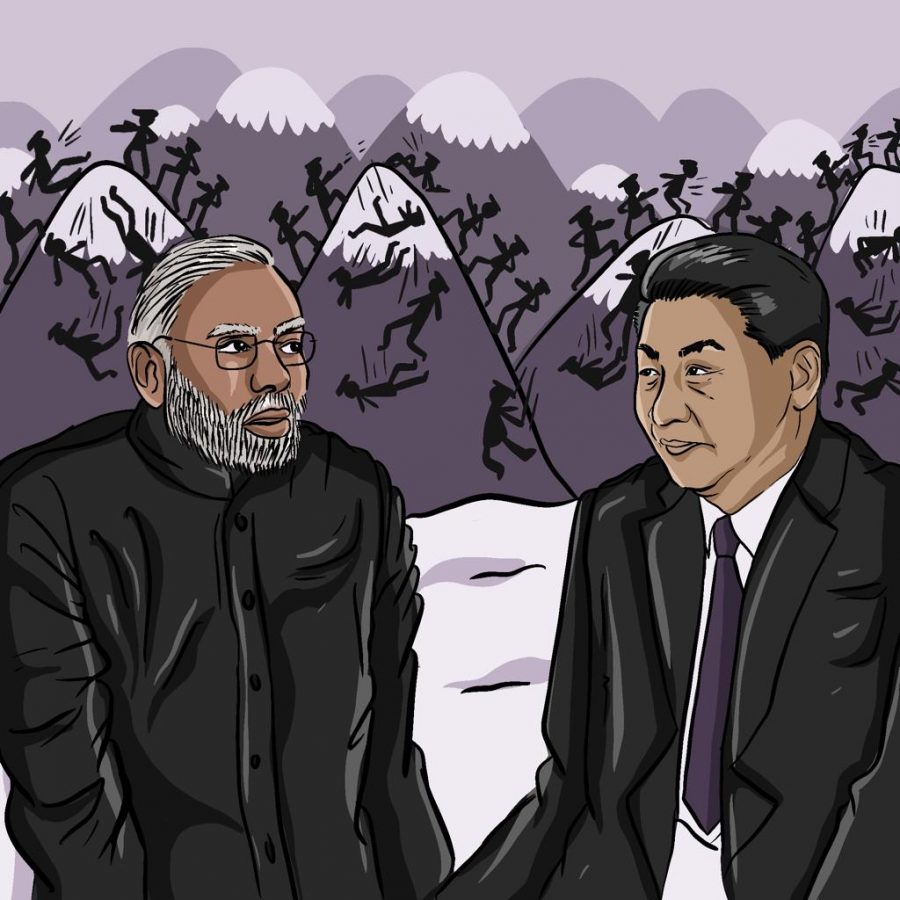
Indian Armed Forces and the Chinese People’s Liberation Army faced off in deadly clashes in the Himalayan region of Ladakh in June of this year; a continuation of the series of armed standoffs along the Himalayas.
Almost 14,000 feet above sea level, the two sides had soldiers wielding fence posts and clubs wrapped in barbed wires, fighting for hours in the Galway Valley. A few Indian soldiers drowned after falling into a river after tumbling from the valley on top. A few others were beaten to death. By the next day, news channels reported a total of 20 Indian troops dead, with US Intelligence reporting that up to 35 Chinese soldiers died as a result of the clashes.
Although the timing of the conflict is not quite surprising, the manner in which the two sides faced off was shocking. Instead of using modern technology in their warfare, both sides used weapons such as sticks and their bare hands to fight each other in the valley. Experts say the clash will be a blow to bilateral relations for years to come. However, India and China have been at odds for years, and they are heading towards a showdown.
But what started this conflict?
1914
In 1914, delegates from China, Tibet, and British India met up in Simla to define the borders of the nations. At the time, China considered Tibet as a part of the nation, despite Tibet declaring independence from China the previous year. The British Raj officials and Tibetan officials agreed to what was known as the McMahon Line. This boundary extended from the northern region of Ladakh to Arunachal Pradesh in the east. In the treaty, disputed territories such as Aksai Chin and Arunachal Pradesh were agreed upon as part of the British Raj. The McMahon Line was not agreed on by the Chinese as they considered Tibet as a part of their country, despite Tibet being recognized as an independent nation. Because the Chinese did not agree to the McMahon Line, this would affect Indo-Chinese relations for years to come.
1962
Fast forward 48 years and the region was completely different. China was a communist state under the rule of Mao Zedong, while the previous British Raj had split into three different states. India was under the rule of the socialist-leaning Congress Party and had close ties with the Soviet Union. Jawarlahl Nehru, the prime minister of India, was friendly with the Chinese and had even given up the United Nation Security Council (UNSC) seat to the Chinese. However, Zedong looked to the Indian controlled territories of Aksai Chin and Ladakh as a slight to Chinese honor and looked to expand their influence in the region.
Additionally, there were a large number of critical roadways near the Xinjiang frontier that China sought to control and establish ties to with the Indian rival, Pakistan.
In 1962, war broke loose, and China invaded the Indian territory.
China violated the boundary that the treaty had agreed to and sent its troops into Indian land. They captured several cities in Ladakh and Arunachal Pradesh. One thing to note however, was that the majority of the Indian army was stationed on the Indo-Pakistan border, so the Chinese faced little to no resistance in the region. Though the war lasted only one month, it resulted in more than a thousand Indian deaths and over 3,000 Indians were taken as prisoners. The Chinese military suffered fewer than 800 hundred deaths.
Premier Zhou Eline called ceased fire by November and unofficially re-drew the borders which was the territory that the Chinese military had acquired. This was called the Line of Actual Control. However, the Indian government does not recognize the Line of Actual Control.
1967
In September of 1967, India and China experienced a clash in Nathu La. The Indian government started work on building a fence of barbed wire in August 1967. Chinese soldiers advanced to the borders and verbally protested while Indian soldiers observed stagnantly. Continued work on the border fence, which developed into a concertina coil, provoked further Chinese protests, and fights ensued.
Beijing sent a warning on September 10th that the Indian government would be held accountable for further intrusions in the China-Sikkim border.
On September 11th, the fence was close to completion, and the Chinese opened fire on the Indian soldiers. The Indian infantry battalion responded with artillery fire, and the Chinese soldiers ended up suffering more casualties than the Indians.
On September 13th, the Indian government offered China an unconditional ceasefire along the Sikkim border. China refused.
On September 15th, China handed back Indian bodies with weapons and ammunition as an act of preserving relations.
Another conflict arose at Cho La where the Indians suffered significantly fewer casualties than the Chinese soldiers.
1987
In response to a perceived Indian military buildup on the Sino-Indian border, Beijing established a forward base on Wangdung Ridge. Tensions are rising and India and China both have outposts within a kilometer of each other, increasing the chances of violent conflict.
New Delhi declared the northeastern border territory of Arunachal Pradesh to be a state, an upgrade from Union territory, as a culmination of the events after Chinese posts were spotted in the Sumdorong Chu Valley, land that Indians believed to be theirs. Prime Minister Rajiv Gandhi lodged an official protest with the Chinese government and summoned the Chinese ambassador to India.
Continuing the events leading up to the status shift of the Arunachal Pradesh territory, Beijing increased its troop presence in the Sumdorong Chu Valley while both nations’ media grappled to drive the political narrative behind the increasing tensions.
2013
Chinese president Xi Jinping made a statement on March 29 declaring that the border issue with India should be declared “as soon as possible”. India accused China of breaching the Line of Actual Control (LAC), which Beijing thoroughly denied.
Jinping had a five-point plan to improve relations between the two countries, and Chinese officials visited India for diplomatic purposes.
Economic ties improved significantly between 2000 and 2012, as bilateral trade went from less than $3 billion to $66.57 billion as a result of government efforts to jumpstart diplomatic relations.
2017
In June of 2017, the Chinese set to create a road in the Doklam Plateau, an area controlled by Bhutan. India sees this as a buffer zone that is close to other disputed areas with China.
Indian troops carrying weapons confronted the Chinese with the intention of destroying the road. A stand-off was issued and there were injuries on both sides.
In August, both the countries called their soldiers and China stopped the construction on the road.
2020
In May, at Lake Pangong Tso, a Chinese force occupied two kilometers of Indian land. The region India responded by pushing them back and ultimately leading them to the deadly clashes of Galwan Valley.
China has bolstered its forces with dump trucks, excavators, troop carriers, artillery, and armored vehicles. India has done the same, and in September, they occupied critical Chinese positions in the area. Political analysts say that neither countries want to escalate the conflict.
Yet, the actions that both the governments have taken otherwise.
In 2019 after India controversially scrapped Article 370 and 35a of its constitution, a major outcry took place among some in the international community- particularly China and Pakistan. India reorganized the territory into three separate parts. It made all Kashmir, Jammu and Leh and Ladakh, a separate state. All of these three are now union territories and are controlled by the Indian government compared to the rest of the country where democratically elected officials control the state.
China views this move as a threat to the CPEC, China-Pakistan Economic Corridor. As the CPEC runs through a part of Pakistan-controlled Kashmir, China views India’s move as a threat to their massive project. Overall, the CPEC is valued at 87 billion dollars and the project has been described as the jewel of the Belt and Road Initiative. However, India’s recent moves in Kashmir threaten Chinese interests, provoking this response. India is now ramping up infrastructure projects in Ladakh, recently completing the world’s longest tunnel above 10,000 feet significantly increasing the infrastructure in the region.
There are several other reasons why Chinese and Indian forces have clashed right now. Some experts believe that this is a Chinese ploy to distract the Indian attention from Chinese naval advancements made in the Indian Ocean, particularly at Hambantota in Sri Lanka and Gwadar in Pakistan. Others believe that this conflict was a result of the fact that India is growing closer and closer to the USA and is in the process of making a North Atlantic Treaty Organization (NATO) style alliance with Japan, Australia, and the USA.
The different proxy trade wars these countries are battling is a testament to how far these countries are willing to go and the latest stand-off back in June is the biggest empirical proof.